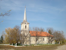
The geographical center of Hungary
is located 1 km NE to Pusztavacs, near a natural reservation area. The stone that stands for this center depicts the map of modern Hungary together with its coordinates.
Coordinates: 47°11' N & 19°30' E.

The center point of the historical Hungarian Kingdom
was calculated in 1880 and set near the Hungarian town of Szarvas. The original windmill was demolished, today's windmill was constructed in 1940 after recalculating the center point in 1932. The center point is located near the Arboretum of Szarvas, at the bank of the backwater of Körös.

The center point of Europe
was calculated first by the Map Institute of the Austrian-Hungarian Monarchy in 1887. The obelisque marking the geographical center stands in nowadays Ukraine, near the river Tisa, close to Dilove.
Coordinates: 48° 30' N & 23° 23' E.

Coordinates: 47°11' N & 19°30' E.

The center point of the historical Hungarian Kingdom
was calculated in 1880 and set near the Hungarian town of Szarvas. The original windmill was demolished, today's windmill was constructed in 1940 after recalculating the center point in 1932. The center point is located near the Arboretum of Szarvas, at the bank of the backwater of Körös.

The center point of Europe
was calculated first by the Map Institute of the Austrian-Hungarian Monarchy in 1887. The obelisque marking the geographical center stands in nowadays Ukraine, near the river Tisa, close to Dilove.
Coordinates: 48° 30' N & 23° 23' E.


No comments:
Post a Comment